Loading borough…
Neighbourhood profile
Churchfields
Redbridge, London
PocketsSouth Woodford High Road (Woodford New Road · The Green · north-east · High Road · Gilbert's Slade · George Lane)Roding (Chigwell Road · Broadmead Road · Elmhurst Gardens)Woodford Wells
Churchfields sits in the north-west of Redbridge around South Woodford, with the Green Belt close by. The twenty-four listed buildings include the Grade II* Hurst House (The Naked Beauty), the Grade II* Raikes Mausoleum and the Grade II* Godfrey Monument in St Mary's Churchyard — a dense set for the ward's size. Green space runs to eighteen hectares led by The Green. A sixth of the ward sits inside a conservation area. Schools are strong with twenty-five outstanding nearby, safety is solid, and non-food venue provision is moderate at sixty-six. Public-transport access is moderate at 3 via South Woodford on the Central line. The drawbacks are narrower than most on this list: culture scores low, market affordability is only moderate, new housing delivery is essentially zero, and heritage weighting is lower than the listed count might suggest.
- Strongest67Nature Access
Strong access to green space and waterways
- Also strong61Safety
Low recorded crime relative to the rest of London
- Watch out0Area development
Little recent major-development activity
At a glance
- Moderate public-transport access
- 24 listed buildings
- 15.6% covered by a conservation area
- 4 schools rated Outstanding by Ofsted within 1 km
- Largest green space: The Green (5.9 hectares)
- 161 open venues (95 food and drink, 66 other)
10 pockets across 3 named areas · coloured by overall score.See on full map ↗
This is one of 684 London wards
Find the London that fits you
Churchfields is one answer. The wizard scores all 684 wards against your budget, commute and priorities, then hands you a ranked shortlist of the areas that actually fit.
5 questions · about a minute · free
Browse listings
Churchfields, layer by layer
Every layer’s score is free. Seven deep-dives — here and on every area, one pass — unlock with the Day Pass ↓
Scores as of 11 Oct 2026 · prices to 2026 · crime to Jul 2026 · air 2022 · sources
Property prices & growth
59Better than 76% of London
How scores work - Purchase affordability60
- Rent affordability60
- Price momentum (5yr)49
- Activity (turnover)68
Locked
Prices, rent & trends
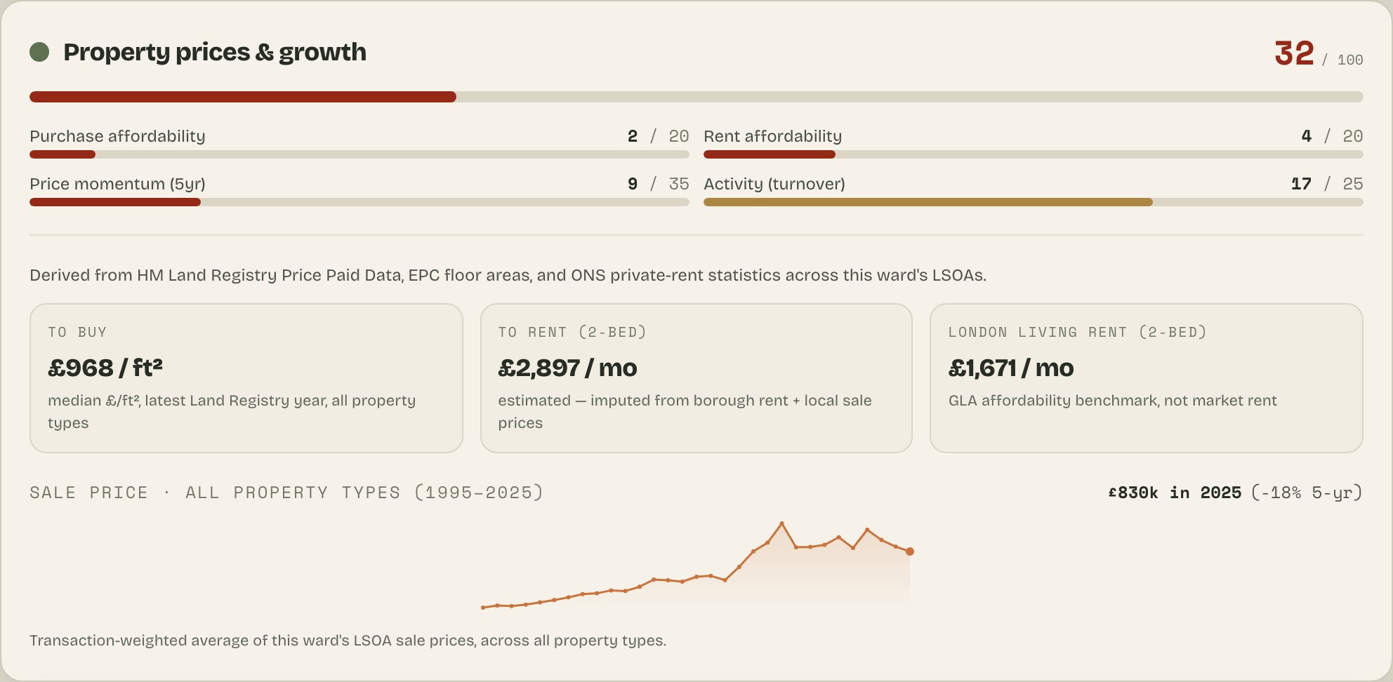
£ per square foot to buy, an estimated 2-bed rent, and decades of sale-price history for this ward.
For Churchfields: 188 sales recorded (2025)32-yr price trend £—
Safety
61Better than 73% of London
- Personal safety63
- Property crime57
- Anti-social behaviour68
Locked
Safety deep-dive
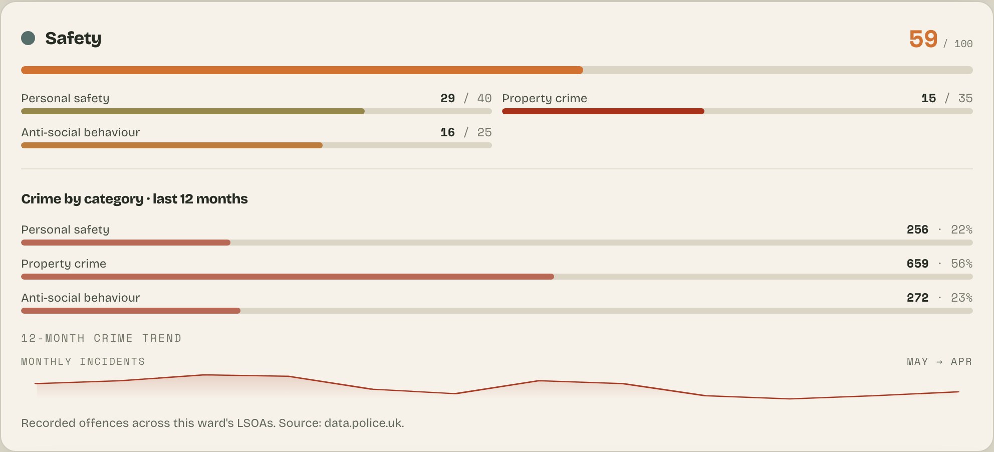
Every recorded crime type — burglary, robbery, vehicle crime and more — grouped into personal, property and anti-social behaviour, with the monthly trend for this ward.
For Churchfields: personal, property & anti-social breakdown24-mo trend to Jul 2026counts —
Connectivity
33Better than 21% of London
Median public-transport access is moderate (TfL PTAL 3.0 of 8 across this ward).
Locked
Connectivity deep-dive
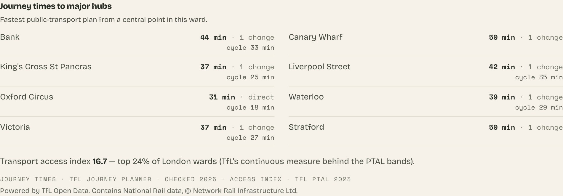
Real TfL journey times to London's major hubs, plus this ward's transport access rank across London.
For Churchfields: — min by TfL to 8 major hubsaccess rank —
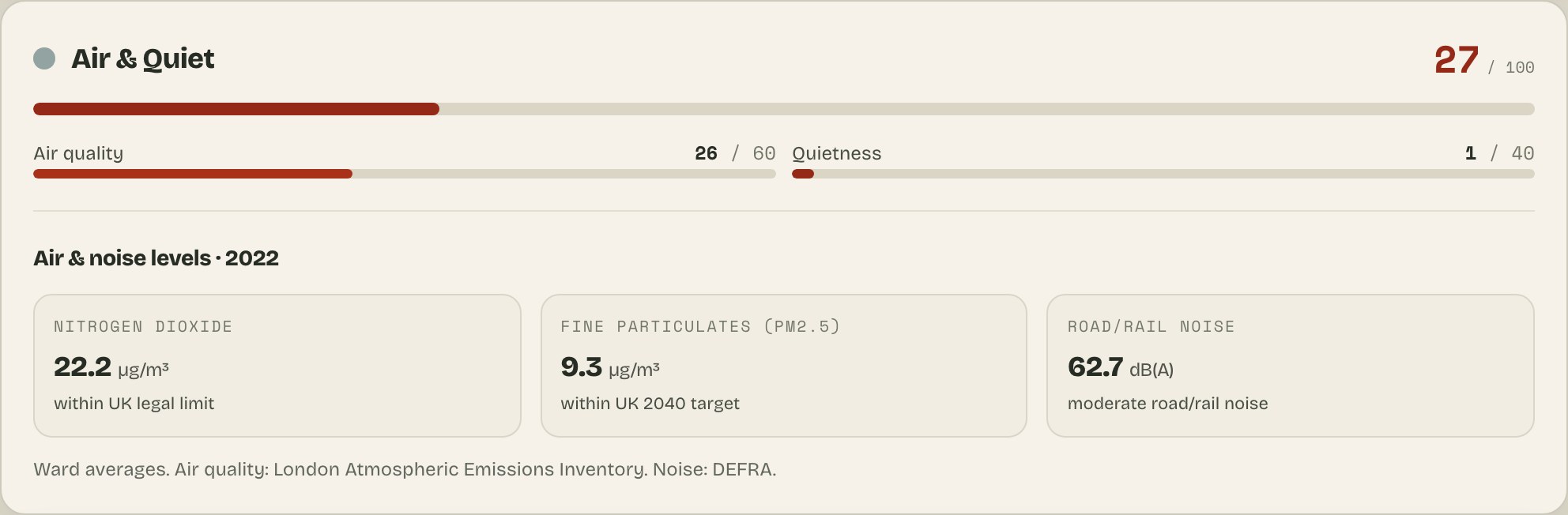
Air & Quiet
55Better than 60% of London
- Air quality53
- Quietness60
Locked
Air & noise deep-dive
NO₂, PM2.5 and road/rail noise for this ward, each against WHO / UK limits.
Cultural Signal
23Better than 49% of London
- Nightlife7
- Dining21
- Arts & culture7
- Retail & shops7
- Sports & recreation7
- Independent scene43
- Vitality (openings, diversity)44
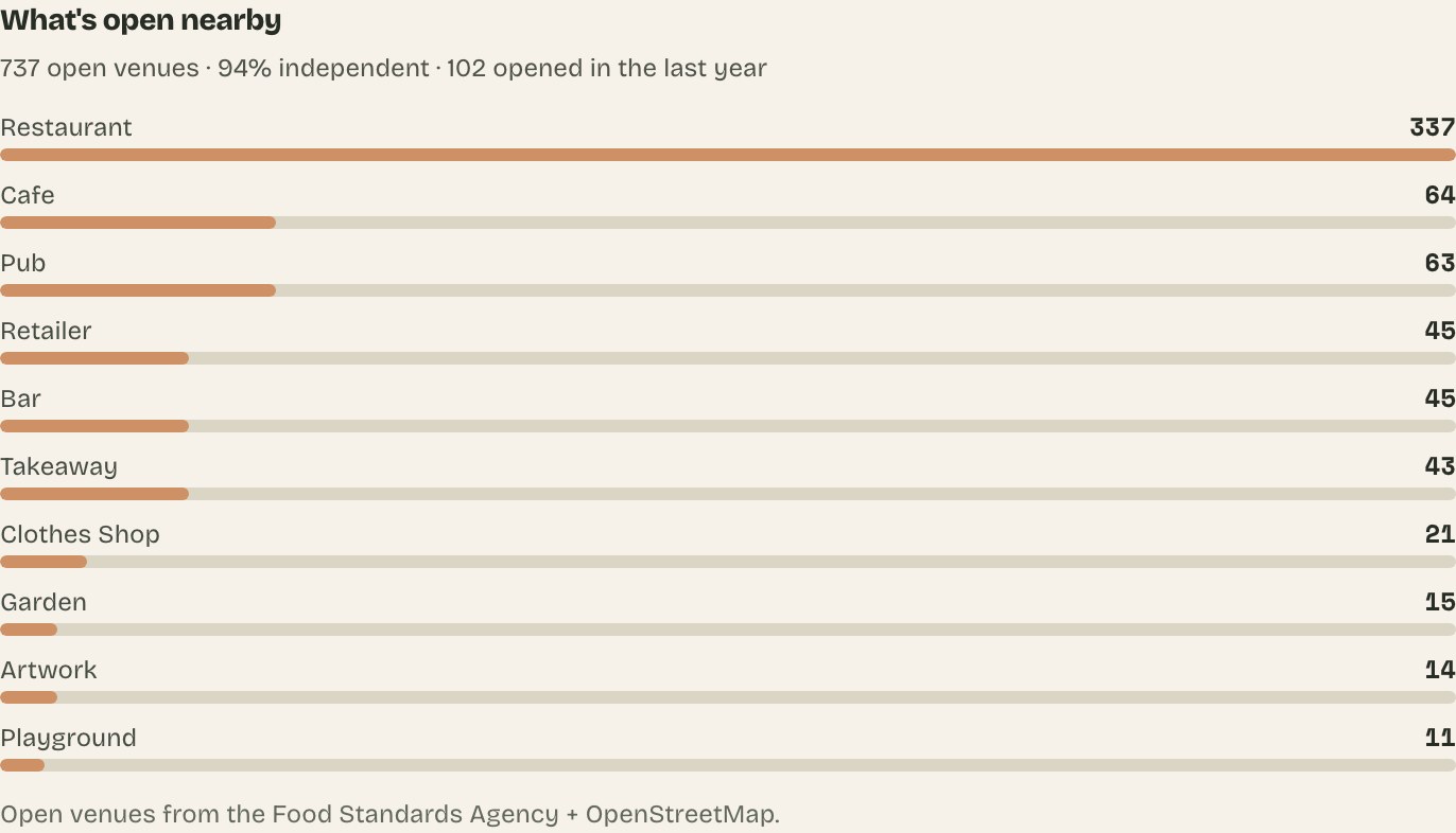
161 open venues nearby — 95 food & drink, 66 other.
Locked
Culture deep-dive
What's open nearby — the venue mix, share of independents, and recent openings.
For Churchfields: the mix behind 161 open venues—% independent
Education
53Better than 50% of London
- Primary schools46
- Secondary schools60
Locked
School inspection history
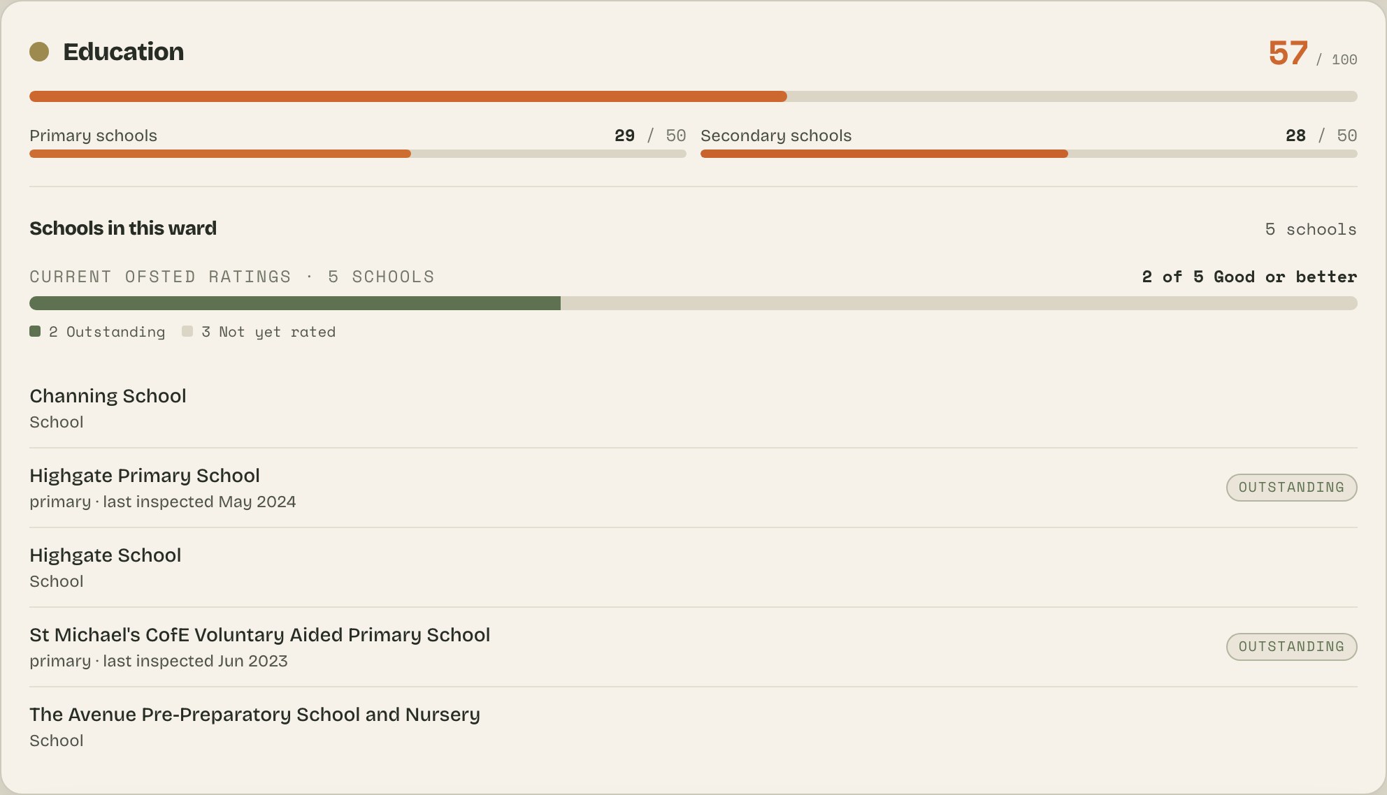
Every school in this ward with its current Ofsted rating and multi-year trend.
For Churchfields: 5 schools, each with its inspection record
Heritage
24Better than 41% of London
24 listed buildings · 16% under a conservation area
- Hurst House, the Naked BeautyGrade II*
- Raikes Mausoleum in St Mary's ChurchyardGrade II*
- Godfrey Monument in St Mary's ChurchyardGrade II*
From Historic England's National Heritage List for England.
Nature Access
67Better than 65% of London
- Green spaces89
- Waterways25
Largest green space: The Green (6 ha). ~18 ha of green space in total.
Area development
0Shared lowest band with 24% of London
Locked
Planning pipeline
Named recent approvals with homes and floorspace, the local homes pipeline, and the affordable share.
Unlock the full details
Unlock the full details for Churchfields — and every other London area
Day Pass or WAYB+ — either one unlocks your full shortlist and every area profile on the site, not just this page.
- Prices — £ per square foot, an estimated rent, and the ward’s full price history
- Safety — crime by type with its monthly trend
- Getting around — real TfL journey times to the big hubs
- Schools, air & noise — every school’s inspection record, air & noise against WHO limits
- What's next — the venue mix, what’s been approved to build nearby, and cheaper areas that score like Churchfields
For Churchfields: 188 sales recorded (2025)32-yr price history £—24-mo crime trend to Jul 2026TfL times to 8 hubs — min5 schools' inspection records161 venues mapped
What unlocked sections look like · example ward, not this one

WAYB+ · month to month
- Everything in the Day Pass — kept on for your whole search
- “What’s changing” on every ward: new approvals, openings and closures, score shifts
- Cancel anytime
Day Pass · 24 hours
A day of full access — every area, your whole shortlist.
- Your full wizard shortlist, revealed
- Every area deep-dive: prices, crime by type, schools, air, commute
- The planning pipeline and cheaper lookalike areas
- Unlimited saves and shareable links
Already bought? Don't pay again — open the confirmation email from where are you based? and tap Restore access to sign back in on this device.
Make it personal
Churchfields might not even be your best match — run the wizard with your own budget and commute. About 90 seconds.
What's changing in Churchfields
Locked
What's changing (WAYB+)
The last 90 days here: new approvals, venue openings and closures, school inspections, score shifts. Subscription only.
Already bought? Don't pay again — open the confirmation email from where are you based? and tap Restore access to sign back in on this device.
Churchfields, quick answers
- Is Churchfields safe?
- Churchfields scores 61 for safety, based on street-level recorded crime (police.uk) — safer than most of London. The score weighs personal safety, property crime and anti-social behaviour separately rather than ranking on one raw total, so the mix of crime matters as well as the volume.
- Is Churchfields a good place to live?
- Churchfields scores 42 overall when all nine data layers are weighted equally. The London comparison beside the score shows how that number ranks against every ward. Its strongest suits are nature access (67) and safety (61); its weakest is area development (0). Whether it suits you depends on what you weight — the same data re-ranked around your own priorities can read very differently.
- How well connected is Churchfields?
- Moderate public-transport access: Transport for London rates the typical spot in Churchfields 3 on its 0–8 public-transport access scale, which puts the ward at 33 for connectivity relative to the rest of London.
- Is Churchfields expensive to buy in?
- Relative to the rest of London, Churchfields is mid-priced by London standards: its purchase-affordability score is 12/20, where higher means cheaper per square foot (HM Land Registry sold prices matched to floor areas).
- What are the schools like near Churchfields?
- Churchfields scores 53 for education, based on Ofsted ratings and walking distance to the nearest rated primary and secondary schools. 4 schools within a kilometre hold an Outstanding rating.
Where else to look
Wards with a similar profile
- Whetstone · Barnet
- Eastcote · Hillingdon
- South Woodford · Redbridge
- Furzedown · Wandsworth
Locked
Neighbourhood matches
Find areas that score like this one, with the price difference for each.
Nearby wards
- Bridge · Redbridge
- Fullwell · Redbridge
- Monkhams · Redbridge
- Hale End & Highams Park South · Waltham Forest
- Hatch Lane & Highams Park North · Waltham Forest
- Upper Walthamstow · Waltham Forest
More affordable, similar areas
- St Helier · MertonMore affordable
- West Hill · WandsworthMore affordable
- Burnt Oak · BarnetMore affordable
- Hanworth Park · HounslowMore affordable
Like Churchfields?
Find a London like this
See the London wards that score most like Churchfields — especially its Nature & parks and Safety.
One quick thing
Is this page accurate?
Got something we missed or got wrong about Churchfields? Let us know.